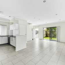
8 Clive Street
Most errands can be accomplished on foot.
Many nearby public transportation options.
About your score
8 Clive Street has a Walk Score of 89 out of 100. This location is Very Walkable so most errands can be accomplished on foot.
8 Clive Street is a six minute walk from the BRBN Brisbane City - Beenleigh line, the DBBN Doomben line - Beenleigh line and the FGBN Ferny Grove line - Beenleigh line at the Fairfield, platform 1 stop.
This location is in the Annerley neighborhood in Brisbane. Nearby parks include Lagonda Park, Ekibin Park South and Robinson Park.
Explore how far you can travel by car, bus, bike and foot from 8 Clive Street.
8 Clive Street has good transit which means many nearby public transportation options.
Rail lines:
FGBN Ferny Grove line - Beenleigh line
0.4 km
BRBN Brisbane City - Beenleigh line
0.4 km
DBBN Doomben line - Beenleigh line
0.4 km
BNBR Beenleigh line - Brisbane City
0.4 km
BNFG Beenleigh line - Ferny Grove line
0.4 km
SHCL Shorncliffe line - Cleveland line
1.9 km
CACL Caboolture line - Cleveland line
1.9 km
DBCL Doomben line - Cleveland line
1.9 km
BRCL Brisbane City - Cleveland line
1.9 km
CLCA Cleveland line - Caboolture line
1.9 km
Bus lines:
100 Forest Lake/Inala - City
0.0 km
115 Calamvale - City via Acacia Ridge Express
0.0 km
117 Acacia Ridge - Woollongabba
0.0 km
125 Garden City - City/Valley via Salisbury
0.0 km
N100 Valley - Forest Lake NightLink
0.0 km
110 Inala - City
0.0 km
124 Sunnybank - City/Valley
0.0 km
112 Griffith Uni Mt Gravatt - City
0.0 km
116 Rocklea - City/Valley
0.0 km
113 Mt Gravatt Central - City
0.0 km
8 Clive Street is in the Annerley neighborhood. Annerley is the 22nd most walkable neighborhood in Brisbane with a neighborhood Walk Score of 78.


If you are using a screen reader or having trouble reading this website, please call Walk Score customer service at (253) 256-1634.
© 2026 Walk Score